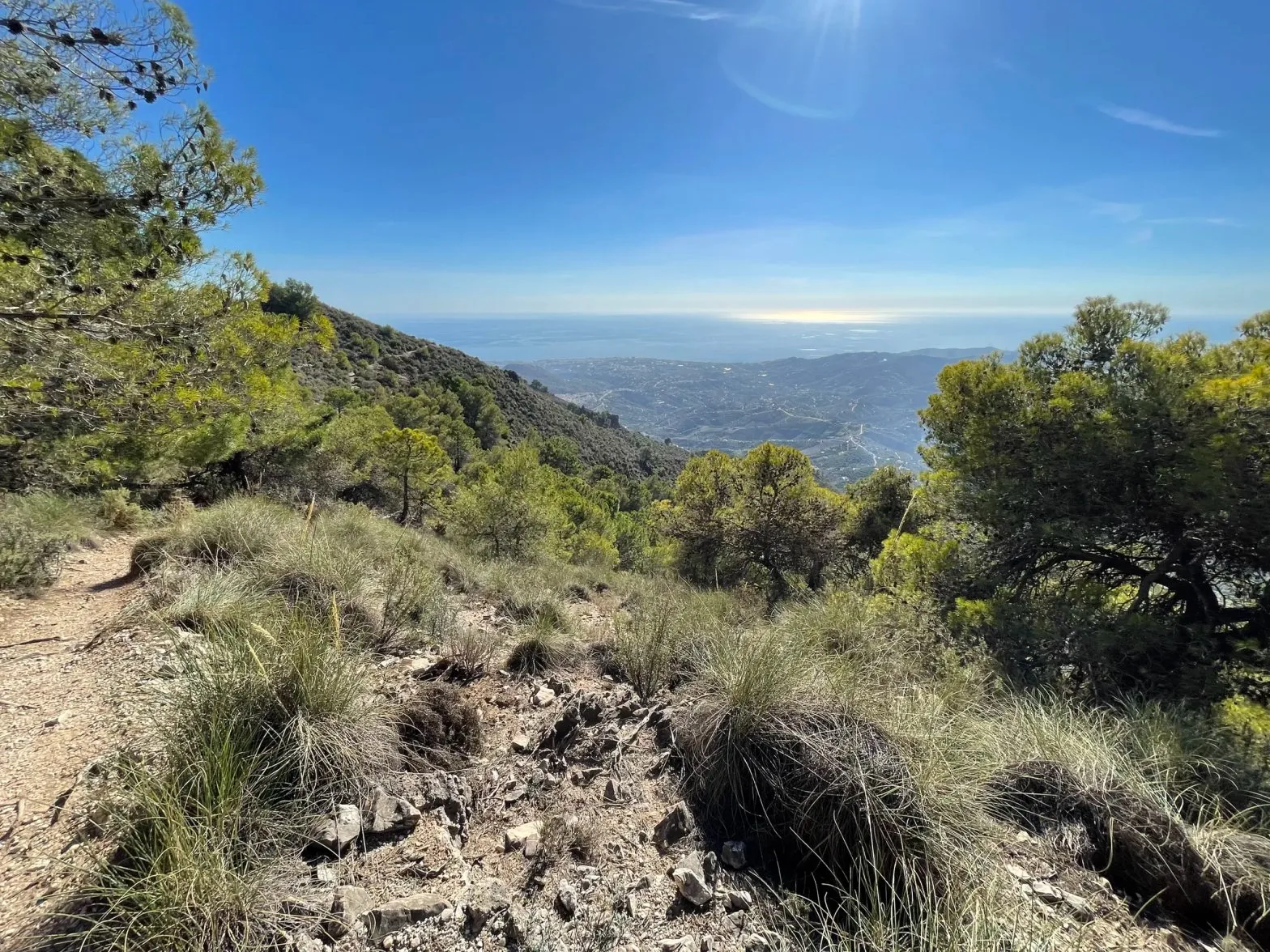
River walks, mountain summits, and coastal trails - the best hiking routes within easy reach of Frigiliana and Nerja in southern Spain.
The hills behind Frigiliana are part of the Sierras de Alhama, Tejeda y Almijara Natural Park - a dramatic limestone landscape of gorges, pine forests, and ridgelines that rise to over 1,800 m. Combined with the coastal paths around Nerja and Maro, the area offers hiking for every level, from flat seafront strolls to full-day mountain ascents. Most trails are accessible year-round, though summer heat makes early starts essential from June to September. The eight walks below run from the gentlest to the hardest, ranked on walking time, which is distance and climbing combined - so the first few suit an afternoon with children and the last two are full mountain days. All eight are plotted together on an interactive map at the foot of the page, so you can see where each one sits relative to La Molineta. The Caminito del Rey follows them, on its own and out of the ranking, because it is two hours away and has to be booked weeks ahead.
How to read these: Every walk carries the same four figures as the rides in our cycling guide: how far it is, how much climbing is in it, roughly how long it takes on foot, and how you get to the start from our gate. Distances and climbing are measured off the actual line drawn on each map rather than copied from a listing, so a figure here and the map under it always describe the same walk - and the listing each route came from is linked under its text, so you can check. Walking times are moving times for a reasonably fit walker: reckon on 3.5 km/h plus an hour for every 500 m of climbing, and add whatever you plan to spend swimming or sitting on a summit. "5 min drive" means five minutes in the car from La Molineta.
1. Cruz de Félix circular
- Distance
- 5 km
- Climbing
- 381 m
- Walking time
- 2 hr 10
- Getting there
- 1 km, steep
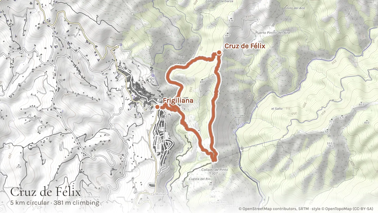
A 5 km circular route from Frigiliana through the Natural Park that packs in dramatic scenery - rocky gorge sections, pine forest, and exposed ridgeline with coastal views. The route passes the Cruz de Félix viewpoint (a metal cross on a rocky outcrop) before looping back through forest trails. Joined on to the Cahorros gorge loop further down the page it makes a longer 7.9 km day, which is how many people walk it. Some sections require sure-footedness and a head for mild exposure - this is not a walk for small children or nervous hikers. It is one of the more technical of Frigiliana's marked routes and easily the most scenic for experienced walkers. Short but steep: 380 m of climbing packed into five kilometres, so allow a little over two hours. It starts from the village, so you can leave the car behind and walk up to the trailhead from our gate: a steep kilometre, on top of the figures above.
Tip: Parts of this route are poorly marked beyond the initial section. Put the route on your phone from the link above before you set off. Good hiking boots are essential - the terrain includes loose rock and steep descents. Best attempted spring through autumn when the trails are dry.
2. El Saltillo suspension bridge, Canillas de Aceituno
- Distance
- 7 km, or 17 km
- Climbing
- 261 m, or 930 m
- Walking time
- 2 hr 25, or 5 hr 55
- Getting there
- 30 min drive
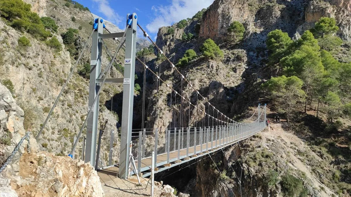
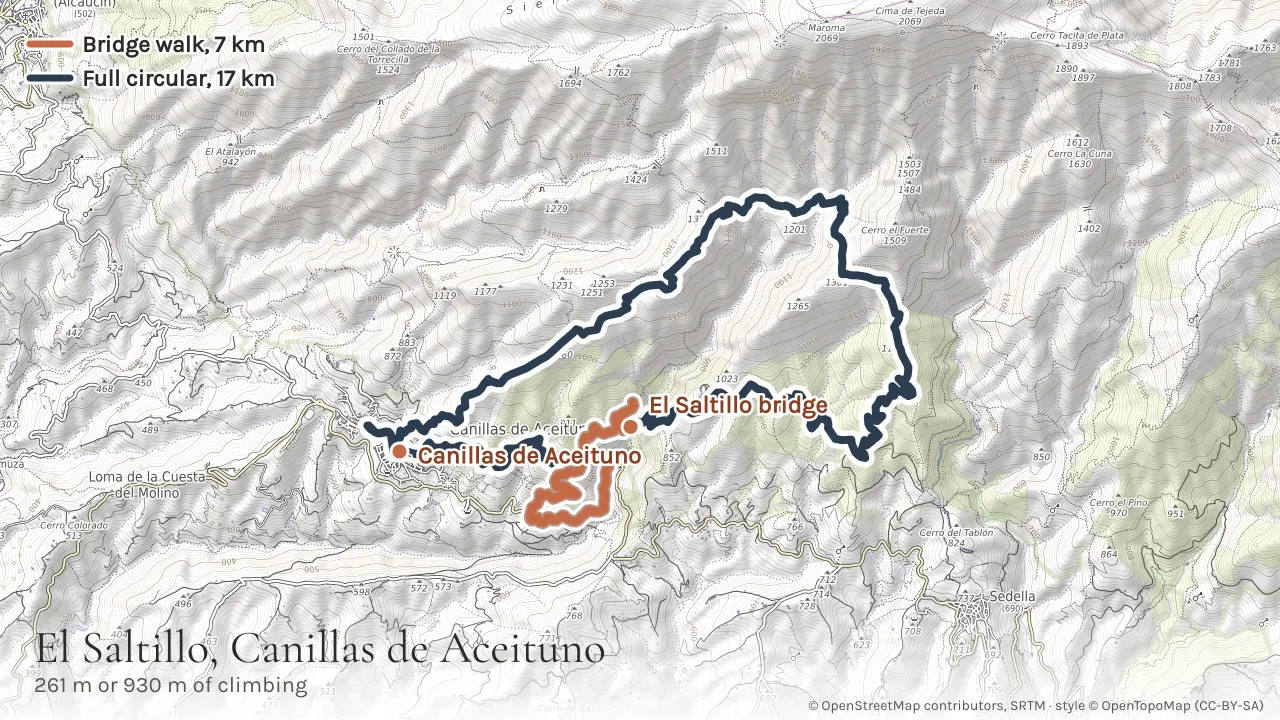
About 30 minutes' drive from La Molineta, Canillas de Aceituno is the start of two walks, and the map below draws both. In terracotta is the 6.6 km walk to the bridge and back: out of the village along an old acequia irrigation channel cut into the hillside, across the recently renovated hanging bridge over the gorge, and back along the same path. Only the last kilometre or so is a loop, the bit that crosses the bridge - the rest you walk twice, which is no bad thing on a path with that view. The bridge itself is the star - a narrow metal walkway high above the river - but the whole route through terraced farmland and rocky hillside is excellent, and it is a morning rather than a day. Moderate difficulty with some exposed sections near the bridge. In deep blue is the full circular, the same path as far as the bridge and then on and up: 16.7 km, 930 m of climbing, 624 m in the village to 1,288 m on the ridge above La Rábita before the long descent back. That is a proper mountain day, about six hours, and it has its own Komoot listing linked below this one. There is also a linear walk on through to Sedella if you can arrange a lift back.
See the bridge walk on Komoot →See the full circular on Komoot →
Tip: The car park fills up quickly on weekends and holidays. Arrive before 10am or go on a weekday. Both routes are signposted out of the village and share the same start. If you are doing the long circular, treat it as a mountain day: start early, carry water for six hours, and check the forecast for the ridge rather than for the coast.
3. Río Higuerón gorge loop
- Distance
- 9 km
- Climbing
- 228 m
- Walking time
- 2 hr 55
- Getting there
- 1 km, steep
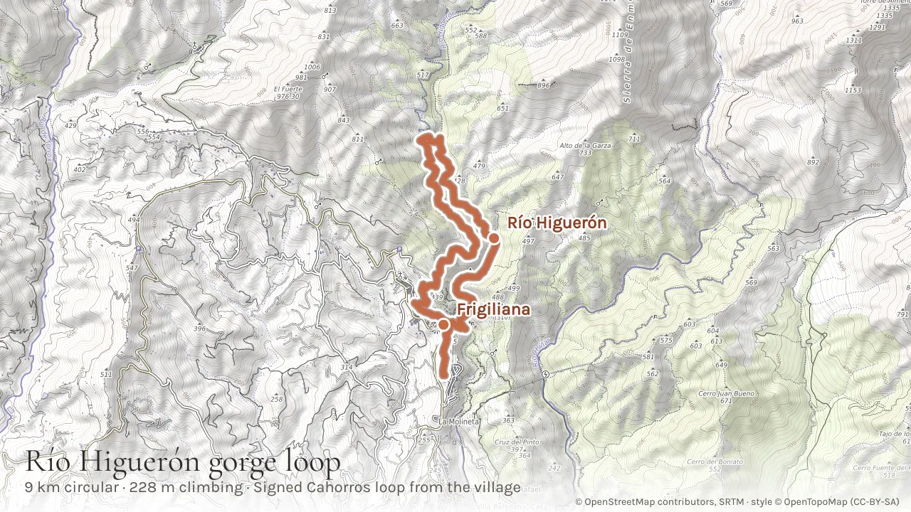
The Río Higuerón starts right from Frigiliana village, so, like the Cruz de Félix circular and El Fuerte, you can do it without a car: it is a steep kilometre up from our gate to the start. The signed Cahorros loop is the version we describe - 8.5 km out of the village, down into a narrowing limestone gorge and back round, with only 228 m of climbing. It has the character of the better-known Río Chillar further down the page with a fraction of the people, and it is the walk to do while the Chillar is closed, which it has been since 2023. Expect to wade ankle-to-knee-deep over smooth rock, and a little scrambling. If you would rather walk the gorge one way, the through-route to Nerja is 7.4 km with almost no climbing and you come back up on the bus - a different walk with a different figure, and not the one the numbers above describe.
Tip: Water shoes with good grip are essential - the rocks here are slippier than in the Chillar. Go in spring or early summer when water levels are pleasant. Do not attempt after heavy rain - the gorge floods fast.
4. Cerro del Lucero (1,774 m)
- Distance
- 10 km
- Climbing
- 645 m
- Walking time
- 4 hr 15
- Getting there
- 45 min drive
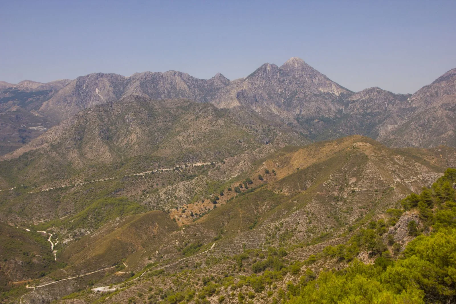
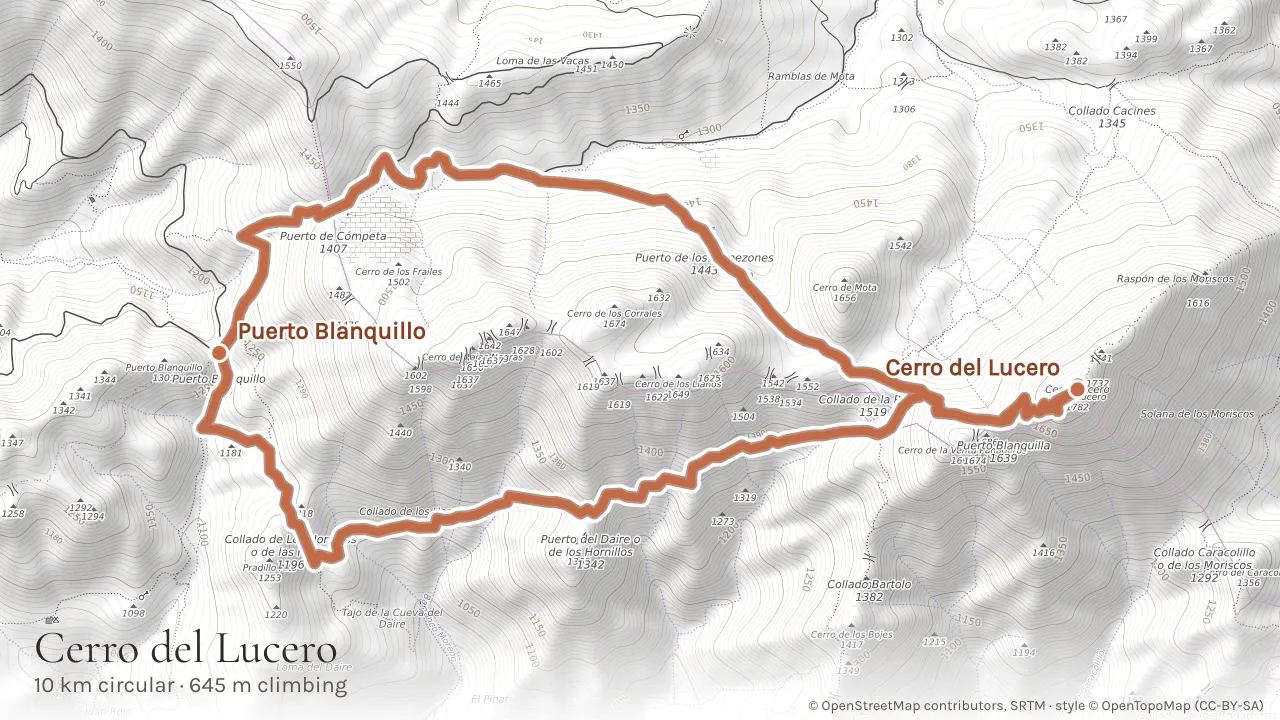
El Lucero is the highest peak in the Sierra de Almijara and one of the finest mountain hikes in the region. At 1,774 m it sits on the border between Málaga and Granada provinces, and the summit views are immense - the Mediterranean coast, the Sierra Nevada, the Granada plain, and on clear days, the Rif mountains of Morocco. The usual approach is from Puerto Blanquillo (reached via a rough forestry track from the Frigiliana-Cómpeta road), and it works as a 10.3 km circuit with 645 m of ascent: up by the Puerto de Cómpeta side and down over the Collado de los Hornillos, so you see new ground all the way round. The final climb to the summit is steep and exposed, through scrub and rocky terrain. Less climbing than El Fuerte below it, but a harder day - the drive in is rough and the upper trails need navigating.
Tip: A high-clearance vehicle is recommended for the unpaved road to Puerto Blanquillo. Carry plenty of water - there are no sources on the mountain. Put the route on your phone from the link above: the upper trails are not well marked. Best attempted October to May; avoid in summer heat.
5. El Fuerte (976 m)
- Distance
- 11 km
- Climbing
- 687 m
- Walking time
- 4 hr 35
- Getting there
- 1 km, steep
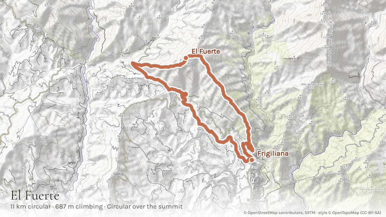
El Fuerte is the prominent peak directly above Frigiliana, with a ruined Moorish watchtower at its summit and 360-degree views of the coast, the Sierra de Almijara and across to the Axarquía hills. Most descriptions send you up and straight back down the same path. There is a better way to do it: an 11.3 km circuit from the village that climbs to the summit and comes down the far side, 687 m of ascent, new ground most of the way round. The trail rises steadily through almond groves and scrubland before a steeper final push. It is a solid half-day - challenging enough to feel earned without needing any mountaineering. The circuit begins and ends in the village, so this is another you can walk to from our gate rather than drive: a steep kilometre up, on top of the figures above.
Tip: Start early in warmer months - there is little shade on the upper sections. Carry at least 1.5 litres of water per person. The summit is a perfect lunch spot. If you do drive, park in the village: the walk finishes where it started.
6. Río Chillar river walk (closed at present)
- Distance
- 15 km
- Climbing
- 571 m
- Walking time
- 5 hr 30
- Getting there
- 10 min drive
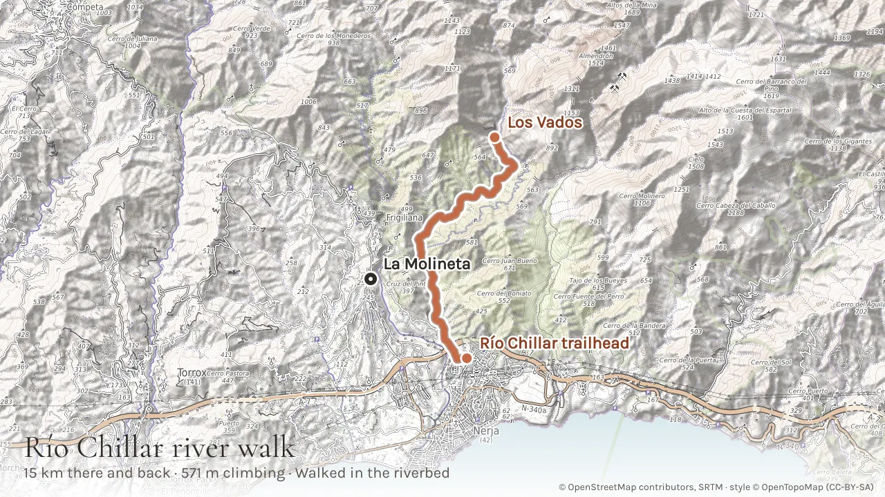
For twenty years this was the most popular hike in the area, and it is still the one everybody asks about. It has been closed to the public since August 2023 and it is closed today. Nerja shut the access points on fire-risk and safety grounds, the Local Police check them daily, and no reopening date has been set. The Junta de Andalucía is working towards bringing it back as a managed, ticketed route on the Caminito del Rey model: two bidders were admitted in 2026 and both proposals cap access at around 500 walkers a day. We have kept it on this list because it will return, and because people arrive expecting to walk it. When it does reopen, it is 7.7 km up the riverbed from the trailhead just north of Nerja, wading knee-deep between marble canyon walls to the Los Vados narrows where the rock closes in and natural pools form, then back down the way you came for a 15.4 km round trip. Until then, walk the Río Higuerón gorge instead - number 3 above, the same character with a fraction of the people, and no car needed.
Tip: Do not plan a day around this one without checking first. Nerja Town Hall publishes the access status at nerja.es and the Frigiliana tourist office will know; entering a closed trail risks a significant fine, and the access points are patrolled. When it does reopen, water shoes or old trainers with grip are essential - the riverbed is slippery marble - and bring a dry bag for your phone.
7. El Pico del Cielo (1,508 m)
- Distance
- 14 km
- Climbing
- 1,107 m
- Walking time
- 6 hr 15
- Getting there
- 25 min drive
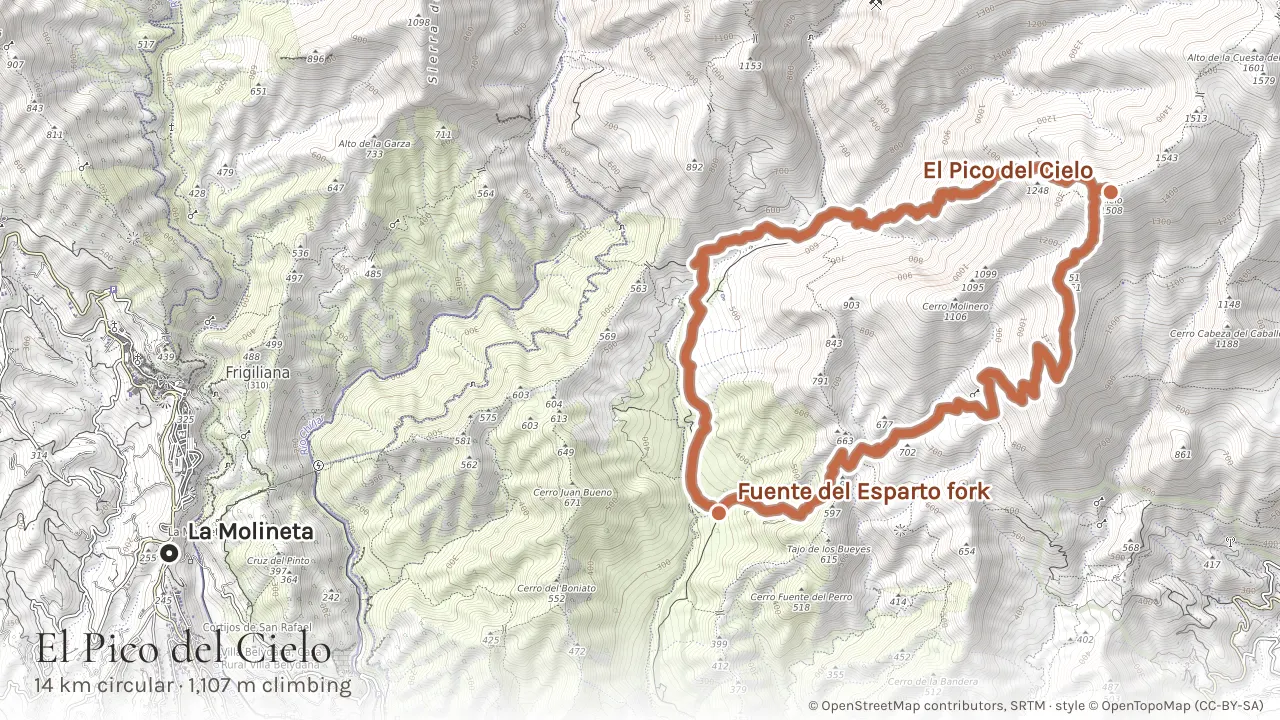
The "Peak of the Sky" at 1,508 m is the summit that dominates the skyline above Frigiliana, and the walk we would send you on starts higher than the guidebooks do. The full PR-A 477 circuit runs 20 km from the coast at Maro, but the first 3 km and the last 3 km are the same forestry track, walked twice, before the outbound and return branches separate - a third of the day for no new ground. Drive that stretch instead. Turn up the Camino Fuente del Esparto by the Cueva de Nerja and follow 3 km of firm gravel to the fork at 344 m, where a guidepost marks the split and there is room to leave a car. From there it is 13.9 km round, climbing steadily through scrubland and pine forest and coming down a different line, so almost none of it is retraced. The final approach involves some easy rock scrambling, and the 360-degree views from the top - coast, mountains, and on clear days, Africa - are extraordinary. It is still a hard hike: 1,107 m of ascent with no shade on the upper sections and no water sources.
Tip: There is a gate on the forestry track at the bottom, by the Cueva de Nerja, with a 1 EUR charge - when it is shut you walk those 3 km each way and the day is back to 20 km, so check it before you set off. Start before 7am in summer. Carry at least 2 litres of water per person. The trail is well-cairned but not always obvious - put the route on your phone from the link above. Spring and autumn are the best seasons.
8. La Maroma circular (2,069 m)
- Distance
- 19 km
- Climbing
- 1,486 m
- Walking time
- 8 hr 20
- Getting there
- 30 min drive
The highest peak in Málaga province, and the biggest day in this guide. Most descriptions send you up the PR-A 352 from El Alcázar and back down the same path, 20.6 km of it. The better walk is a circuit from Canillas de Aceituno, the same village as the Saltillo bridge and half an hour from our gate: 18.9 km, 1,486 m of climbing, up by La Rábita and over the summit at the halfway point, then down a different line past the Los Caleros marker. It is a harder day than the there-and-back despite being nearly two kilometres shorter, because the circuit loses height at La Rábita and has to climb it again. The reward is the summit plateau, vast and flat and open, with views to Granada, the Sierra Nevada and the whole coast. Snow can linger at the top into April. This is a serious mountain hike: navigation skills and proper gear are required.
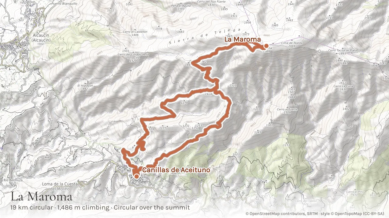
Tip: Check weather conditions before setting out - cloud can roll in fast. This hike is best October to May. In summer, the heat makes it inadvisable except for very early starts. The line on the map is a recorded walk rather than a plotted one, which is worth having on your phone here: the upper sections are cairned rather than signed.
Further afield: the Caminito del Rey
- Distance
- 8 km
- Climbing
- Downhill overall
- Walking time
- 3 to 4 hours
- Getting there
- 1 hr 55 drive
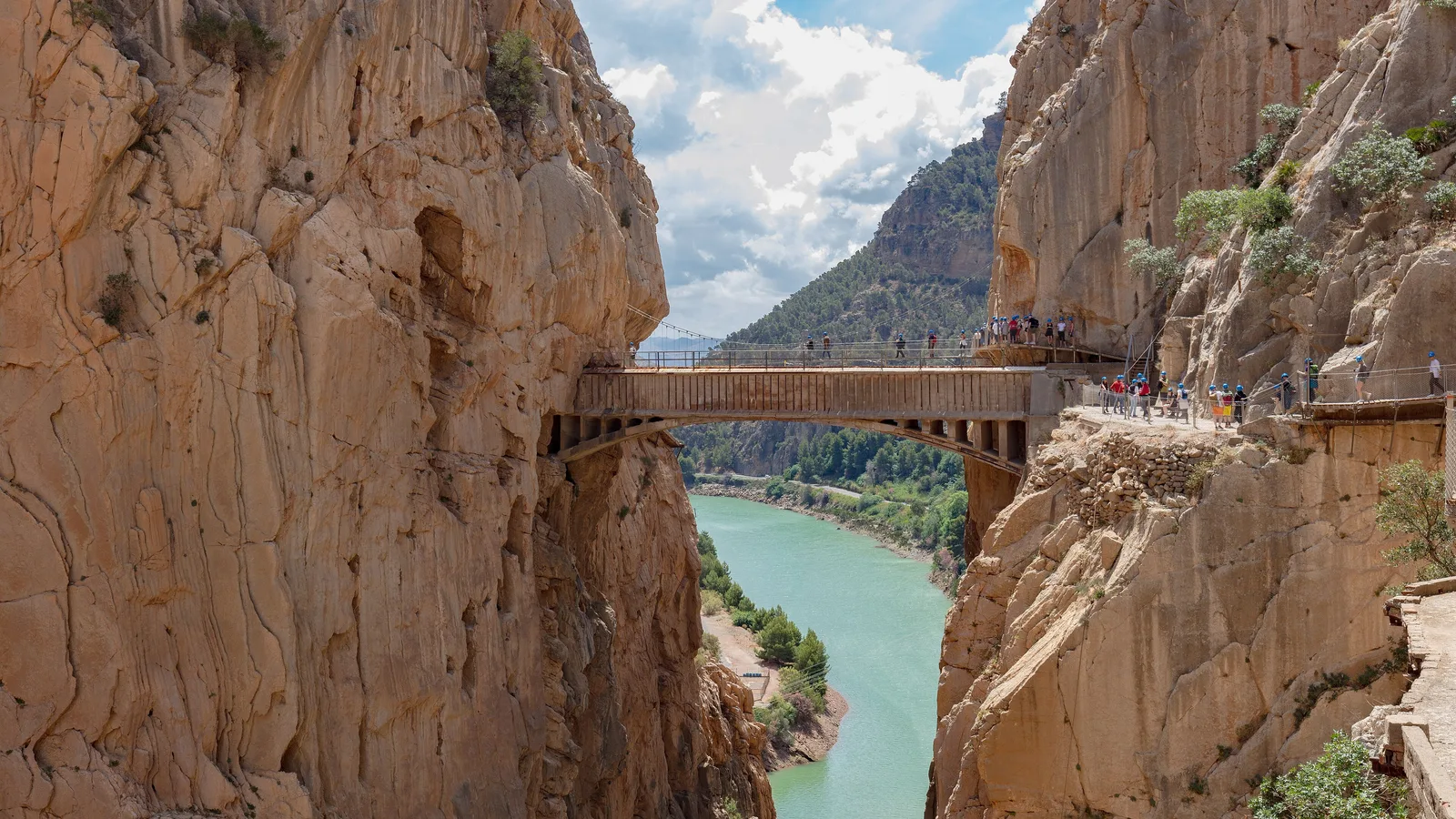
The one walk here that is nowhere near Frigiliana, and the one guests ask about most, so it earns its place at the end. The Caminito del Rey is a boardwalk pinned to the walls of the Desfiladero de los Gaitanes north of Málaga, a metre wide in places and a hundred metres above the river. It was built for hydroelectric workers in 1905, left to rot for decades until it was genuinely one of the most dangerous paths in Spain, and rebuilt as a safe route in 2015. The official distance is 8 km and it takes three to four hours: a wooded access track down from El Kiosko at the Ardales end, then the walkway itself through two gorges and a wide valley, then a descent to El Chorro station. It runs one way only, North to South, so there is no turning back once you are on it, and the walking itself is easy - the difficulty is entirely the exposure. Children under eight are not allowed on it at all, and under-18s must be with an adult. From our gate it is about an hour and fifty-five minutes to the North entrance, so treat it as a full day rather than a morning.
Book Caminito del Rey tickets →
Tip: This is the one walk in the guide you cannot do on a whim. Tickets are 10 euros general admission, or 18 euros with an official guide, and they are released in blocks a few months ahead - spring and autumn dates go weeks in advance, so book before you travel rather than after you arrive. Helmets are compulsory and handed out at the North gate. Park at the Visitors' Reception Centre for 2 euros a day and use the shuttle bus between the two ends: 2.50 euros a head, cash only on board, valid in both directions all day. Opening is from 9am with the last entry at 2.50pm or 5.20pm depending on the season, and the walkway closes in high wind, so check the official weather page the night before.
Practical tips
Wikiloc and AllTrails both have extensive route libraries for the area with downloadable GPS tracks. For a comprehensive printed guide, Walk! the Axarquía by Charles Davis (Discovery Walking Guides) covers 38 routes across the Sierra de Tejeda and Almijara with detailed maps and GPS waypoints - it is the best single resource for hiking in this area. Always carry water, sun protection, and a charged phone. The terrain is rocky and limestone can be sharp - good hiking boots are essential for anything beyond the coastal paths.
Map
Tap markers for details. La Molineta shown in terracotta.
Planning a trip to Frigiliana? Our villas are just minutes from the village - book direct for the best price.